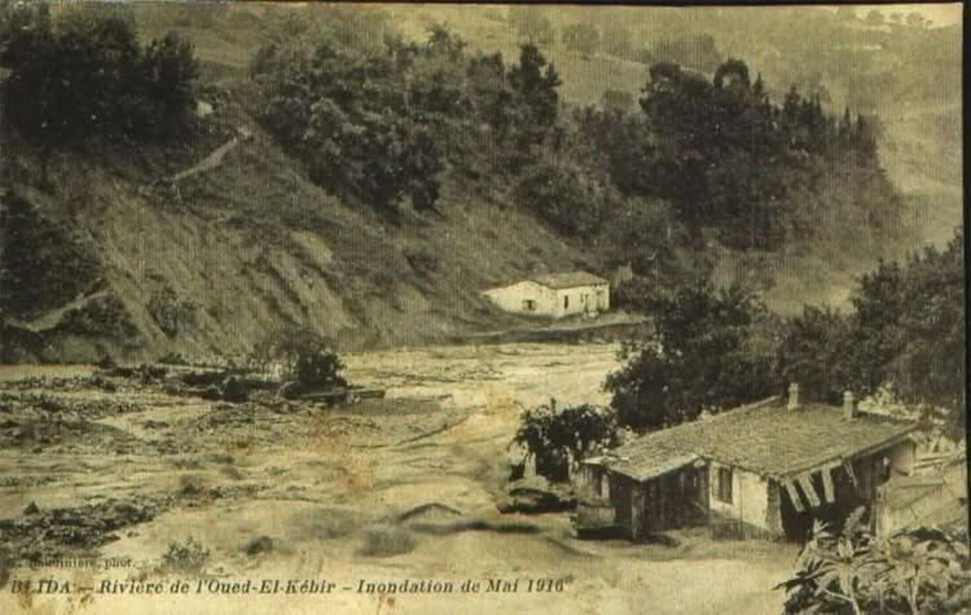
The Flood of Oued El Kebir
A catastrophic flood struck the Blidean Atlas and the outskirts of Blida city when the Oued El Kebir overflowed its banks, causing widespread destruction across the region.
1 January 2025
Overview
The Flood of Oued El Kebir was a major natural disaster that struck the Blidean Atlas and the outskirts of Blida city. The Oued El Kebir ("the great river") drains the northern slopes of the Blida Atlas, flowing across the Mitidja plain. When heavy rainfall overwhelmed the river's capacity, floodwaters inundated agricultural land, infrastructure, and settlements on the city's periphery.
The Oued El Kebir
The Oued El Kebir is one of the principal watercourses of the Mitidja basin. Its valley forms a natural corridor between the Atlas mountains and the plain, and has historically been both a resource and a hazard for Blida's agricultural hinterland.
Impact
The flood caused significant damage to farmland on the Mitidja plain — at the time one of Algeria's most productive agricultural zones under French colonial cultivation. Road and rail infrastructure connecting Blida to Algiers was disrupted.
Connections
- The Atlas foothills and river system are best understood alongside [[lifestyle/places/parc-national-chrea|Chréa National Park]], which protects the upper watershed
- The Mitidja plain's agricultural heritage is reflected in [[lifestyle/food/la-metidja|La Metidja restaurant]] — named after the plain itself
- See related geological hazards: [[archives/history/earthquake-1825|Earthquake 1825]], [[archives/history/earthquake-1867|Earthquake 1867]], [[archives/history/earthquake-1931|Earthquake 1931]]