Earthquake of 1867
A magnitude-7 earthquake struck on 2 January 1867 with its epicentre at Mouzaïa, severely impacting Blida and the surrounding Mitidja region.
1 January 2025
Overview
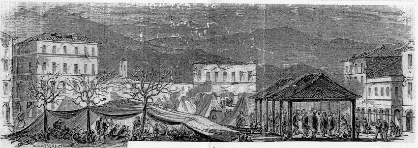
On 2 January 1867 at 07:13, a powerful magnitude-7 earthquake struck with its epicentre at Mouzaïa — a commune in the Atlas foothills south-west of Blida. The tremors severely impacted Blida city and the surrounding Mitidja plain.
Impact
Buildings across Blida that had been reconstructed after the [[archives/history/earthquake-1825|1825 earthquake]] suffered renewed damage. The French colonial administration organized emergency relief, and many structures were once again rebuilt or reinforced. The repeated seismic destruction contributed to the eclectic architectural character of the city — layers of Ottoman, early colonial, and later colonial construction.
Geological Context
Blida sits at the northern edge of the Blida Atlas (Tell Atlas), a tectonically active zone where the African and Eurasian plates interact. The Mouzaïa fault system has been a recurring source of seismic activity throughout the city's history.
Connections
- Preceded by the [[archives/history/earthquake-1825|1825 Earthquake]] and followed by the [[archives/history/earthquake-1931|1931 Earthquake]]
- Mouzaïa commune is south of Blida, on the approach to [[lifestyle/places/parc-national-chrea|Chréa National Park]]
- Colonial-era church architecture affected includes [[culture/religion/saint-charles-church|Saint-Charles Church]] and [[culture/religion/jules-ferry-church|Jules Ferry Church]]